Battle of Maldon, Maldon

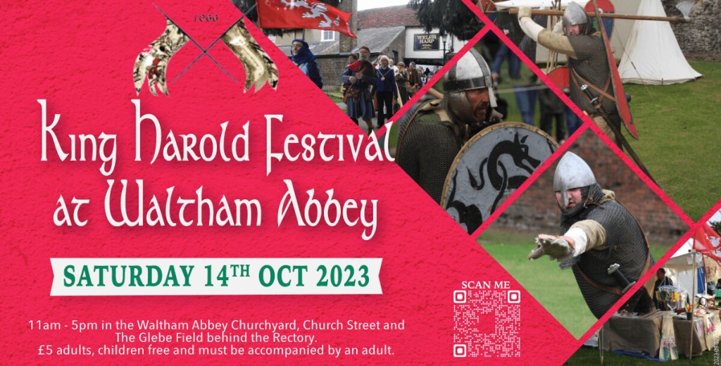
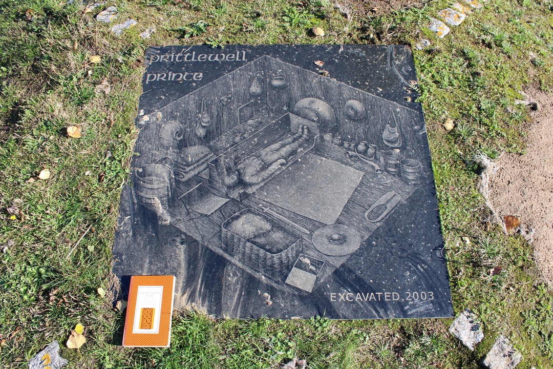
Links: https://what3words.com/headless.perch.snares

Map of the location, original version by Dave Beard, Medieval World 1991

Only a few Anglo-Saxon battles have managed to escape the realm of specialist interest and capture the imagination of the general public. The Battle of Maldon, that took place in 991CE between local forces and Viking invaders, is one of these.

The main reason for this level of interest is probably the Old English poem that is usually called ‘The Battle of Maldon’. If it had a different title this is lost as the the beginning and end of the poem are missing, but there are still 325 lines which provide lots of interesting detail. However these were also nearly lost as in 1731 the only known manuscript of the poem was destroyed in the fire. Thankfully a copy had been made only a few years before, which is the version we have today.

During the latter part of the 10th century the English royal policy on how to respond to Viking raids was divided. Some advocated for paying off the Viking invaders, while others believed that combat was the more effective strategy. The poem indicates that a Byrhtnoth, who was a Ealdorman of Essex favoured combat.

John Doubleday’s statue of Byrhtnoth stands proudly at the end of the promenade

The poem describes how the Vikings sailed up the River Blackwater and the Anglo-Saxons under Byrhtnoth’s command came to face them. His forces included a number of trained troops, complemented by local farmers and villagers who formed a militia called the Essex ‘fyrd’. The Vikings landed on a small island connected to the mainland by a land bridge during low tide. They offered to depart if paid, but Byrhtnoth refused.

The view towards Northey Island at high tide

As the tide receded, the Vikings initiated an assault across the land bridge. However, three select Anglo-Saxon warriors, Wulfstan, Ælfhere, and Maccus, successfully thwarted their advance. The Viking commander, who is nameless in the poem, then requested that Byrhtnoth allow his forces onto the shore for a formal battle, and for an unknown reason, Byrhtnoth consented. The battle commenced, but at a pivotal moment, an Englishman named Godrīc seized Byrhtnoth’s horse and fled. His brothers followed him and subsequently many Anglo-Saxons who mistook the person on the horse for Byrhtnoth also fled, thinking he was abandoning them. This caused confusion, allowing the Vikings to defeat the Saxons, albeit with significant losses. Tragically, Byrhtnoth was killed, and his decapitated body was later found with his gold-hilted sword still by his side.

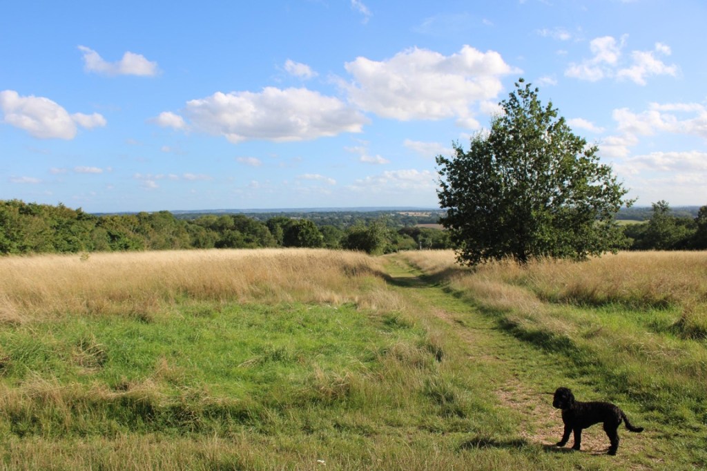
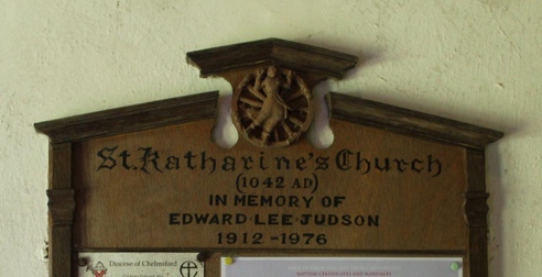
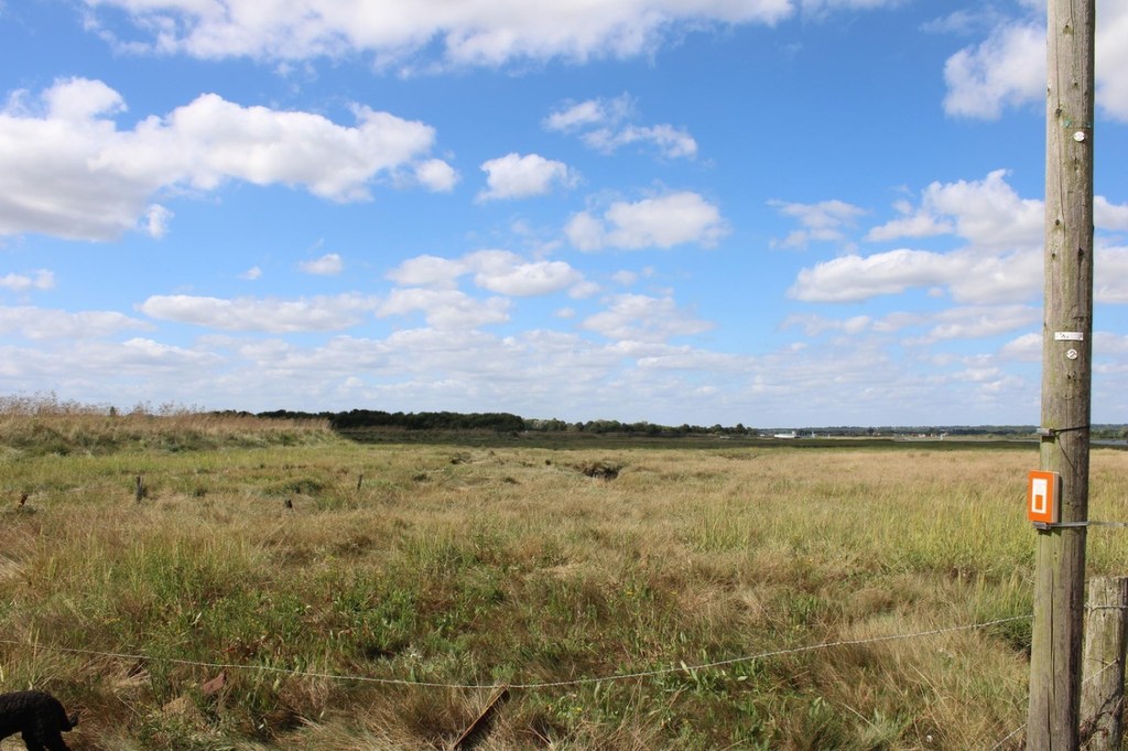
Although we know the general location, battlefields of this period are infamously difficult to pin down. So the poem, with it’s detail is a great help in finding the exact location. Following the many clues in the poem, Northey Island which is 2km to the east of Maldon seems to be the best match. Today it is still linked to the mainland by a land-bridge which is submerged at high tide, but is likely much longer today than it would have been at the time. Unfortunately there is very little archaeological evidence to confirm it is the site. Byrhtnoth’s body was taken to the Ely cathedral to be buried and it is likely that lots of other bodies were removed.

The view out over the likely site of the battlefield

Byrhtnoth’s death and the sacrifice of his retainers who fought on after his beheading seem to have saved Maldon from immediate attack. However whatever losses the Viking’s sustained, both in men and a lack of payment, it did nothing to stop them returning to Essex later. It may also have caused the king at that time, Ethelred the Unready, to give in and pay the Vikings what is called Danegeld, something he gathered through imposing taxes on his subjects.

Statue of Byrthnoth
Byrhtnoth guarding the approach to Maldon

Byrhtnoth’s sacrifice has lived on. It inspired J.R.R. Tolkien to write a poem published just before ‘The Fellowship of the Rings’, in which two men retrieve his body from the battlefield. Then in 2006 a statue of him, created by a locally born sculptor, was installed at the end of the Maldon breakwater, forever looking down the River Blackwater and continuing his guardianship of Maldon.

Links:

Danbury Camp, Danbury

Location: https://w3w.co/clots.incur.fencing

Situated at one of the highest points in Essex, approximately 6 km from Maldon, is the ancient earthwork known as Danbury Camp. Believed to be initially a late Iron Age construction, it originally consisted of a vast defensive earthwork encircling an area of strategic high ground. Unfortunately, much of it has been lost due to erosion over time, and a significant portion has been built over. However, careful observation reveals remnants of the earthwork in the landscape, such as in the positioning of hedges or the contours of the terrain.

The view southwards from the hillfort

The exact purpose and history of Danbury Camp during the Anglo-Saxon era remain subjects of debate among historians. It is speculated that the camp might have functioned as a fortification in the early medieval period, possibly serving as a defensive location where the local population could shelter against Viking raids.

A view along the edge of the embankment also showing the backs of houses built there

Archaeological excavations of the main site occurred in 1974 and 1977, complemented by smaller investigations spurred by local construction. The minor dig have found little to nothing but the two major ones have uncovered Iron Age artefacts as well as several Saxon items. Notably, these finds included loom weights, pottery shards, and a double-sided Saxon bone comb, suggesting domestic occupation from the 8th to the 10th century. While the re-occupation of Iron Age hill forts was common in southwestern England, it is much rarer in Essex.

The notice board
The notice board found next to the church’s car park

Due to the extensive damage to the site, to the casual observer the most visible indication that it exists is probably the notice board outside the Anglican church of St John the Baptist. The oldest part of the church is its north aisle, which is thought to have been part of a chapel endowed by the St Clere family in 1290. If there was a wooden Anglo-Saxon church there before it then that has disappeared completely. However, like so many other similar churches, pieces of Roman brick can be found in the lower part of the north wall.

The Parish Church of St John Baptist dominates the site of the Danbury Camp
Although there is little record of roman presence in the area, never the less roman brick can be found embedded in the walls of the church

The remains of the Danbury camp are there if you look hard enough and while it may not boast the grandeur of larger historical sites, its understated presence reminds us of a time when such a construction was necessary.

Links:

St Katharine’s, Little Bardfield

Location: https://w3w.co/clots.incur.fencing

Between the Essex towns of Saffron Walden and Braintree is the village of Little Bardfield. In the middle of this parish sits the Grade I listed church, St. Katherine’s.

A large portion of the church’s structure is of Anglo-Saxon construction. Both the nave and the impressive West Tower were built sometime before the conquest, the proof of which can be seen in several ways. First, the walls are made of flint, rubble and partly dressed with clunch, which is a chalky limestone. Like so many other buildings from that time, the walls also include some Roman bricks and tiles which were most likely recycled from material gathered locally. At their base the walls are about a metre thick, but taper slightly as they rise. Also, when compared to the later additions of the chancel and organ chamber the alignment of the original walls is somewhat skewed.

View towards the alter at the eastern end
View towards the altar

The church has undergone a number of modifications which have removed Saxon features. The easternmost window in the north wall of the nave was a Saxon round-headed one which has now been blocked off. While the imposing West Tower, which was built in five stages, is accessible via a 15th century archway, and has had a western doorway which has also been blocked off.

Notice Board
The notice board inside the church

An exact construction date isn’t known, but the church proclaims on its notice board the very precise date of 1042. When the village was recorded in the Domesday book in 1086 it was listed as having 83 households. This would have made it one of the larger settlements recorded so it is unlikely that such a large community would have such a recently built church. That might mean that this church is older than the date given, or more likely, an earlier humbler church preceded it.

The Easter Sepulchre found in the north wall of the nave

Finally, although not an early medieval detail, it is worth pointing out what is likely a medieval Easter Sepulchre in the north wall. This would be for the Easter ritual where a cross and sacrament would have been wrapped in Linen and then ‘buried’ in the alcove on Good Friday. On Easter morning it would have been retrieved and paraded around the church as part of the celebration.

Links:

St Mary’s, Great Canfield

Location: https://w3w.co/guarding.anthems.sunflower

In the small village of Great Canning, accessible from the B184, you can find the Grade I listed Church of St Mary’s. It bears all the hallmarks of a Norman church but if you look carefully there are a number of fascinating secrets.

The church was built around 1150 CE and may have replaced an earlier wooden building in the same location. It was added to in the 15th century when a belfry, spire and south porch were added. It is likely the church for Alberic de Ver’s manor who is listed as the owner in the Domesday Book. This would mean it is also related to the Norman motte and bailey that can be found just behind it and which sits in the bend of the River Roding.

The church contains a number of treasures including a very rare one of the Virgin Mary and Child from the early 1200s, which was painted over in the Reformation but not destroyed. This means that access to the interior of the church is very restricted.

Top of one of the Pillars (2014) ©NorthernVicar.co.uk

However if you can gain access the most visible of the surprises can be found on the pillars at the south doorway. They are richly carved with two faces at the top. These faces are very likely Odin as on the left hand pillar his face has two ravens making up part of his face. These are likely Hugin and Munin who are his messengers and spies. Around the faces are also what are called fylfots but would be better recognised today as Swastikas; a symbol common in pre-Christian cultures across Europe.

A collection of stones, flint and possible Roman brick found in the wall of the church

More surprisingly, close to the entrance near the Norman archway to the chancel if you know where to look you will find an 11th century Viking burial stone embedded in the fabric of the building. Because of its height and position it can only really be seen with the aid of a mirror on a log rod that allows you to look down on it. It is likely that the gravestone is that of a Viking warrior that was killed in the area and then recycled into the fabric of the church in the same way that Roman bricks can be found in the outside wall.

The village of Great Canning is tiny and seems like a picture postcard example of the English village, however the church and Motte and Bailey are well worth a visit.

Links

St Mary The Virgin, Chickney

Location: https://w3w.co/balancing.holly.standing

The church of St Mary The Virgin, sits directly between the Essex towns of Thaxted and Elsenham. As you drive along the B1051 a single small sign points you down a rough gravel track towards it. After about 600m you will come across the Grade 1 listed building hidden by trees.

The church is amongst the oldest one found in Essex and was the parish church of the small village of Chickney. The village has always seemed to be small, only ever consisting of a few farms, the Church and Sibley’s farmhouse which once gave its name to a now vanished train station. The population was as high as 42 in 1881, but in 2011 there were only around 34 residents recorded. In the Domesday Book it was called ‘Cicchenai’ and then in 1230 it was called ‘Chickenye’. This probably comes from the Old English for ‘Chicca’s island’, or perhaps even ‘chicken island’ although there are no large bodies of water close by.

St Mary’s was officially closed in 1972 when its parish was merged with that of St Mary’s Broxted. Control and maintenance of the church was then given to what is now The Churches Conservation Trust in 1974. It still remains consecrated.

St Marys
The small Saxon window is visible at the top left

There appears to be no record of any other church that predates the stone building and while many authorities date it from around 1000 CE, it has been suggested that it may be as old as about 850 CE. It was originally built from local flint and rubble and has an uneven shape which is not quite rectangular. The churchyard is oval, which may indicate that the ground was sacred in pre-Christian times. What remains of the Anglo-Saxon church is the nave and short chancel, and perhaps a rounded apse at the eastern end. A lot of this is still visible, most notably it has two Anglo-Saxon narrow slit windows situated high up. The openings to them are splayed both outwards and inwards with the narrowest part in the middle. They are glazed now but would not have been like that originally. This arrangement can be seen in several flint churches in East Anglia.

View toward the Altar
The Altar stone or mensa. Two of the engraved crosses are visible

It is noticeable that unlike Greensted, it is not a working church, it’s emptiness gives it a completely different feeling. However it still remains a tangible link to the Anglo-Saxon past of England. St Mary’s is well worth a visit if you can find it because it is a hidden gem that holds the stories of a bygone era within its ancient stones.

Links

St. Andrews, Greensted

Location: https://w3w.co/charmingly.dusty.weedy

Entrance to the church. Hidden on the left is the grave of a 12th Century Crusader, possibly a bowman

Nestled in a serenely quiet part of the Essex countryside lies the Grade I listed St Andrew’s Church at Greensted. It is a small unassuming church reachable by an equally unassuming side road. On closer inspection the church, who’s full name is ‘The Church of St Andrew, Greensted-juxta-Ongar’ has walls which are composed of split logs, taken from oak trees and put together using a ‘stave-built’ construction technique. This was quite common in the Nordic countries but was rarely seen in England, making St Andrew’s an architectural rarity. It also holds the title of oldest wooden church in the world and the oldest ‘Stave Built’ timber building in Europe.

Side view of St Andrews
End view of the Nave

In 1960 an archaeological investigation inside the chancel concluded that there had been two earlier wooden buildings on the same site dating back to the 6th, and 7th centuries. In the same year an investigation on behalf of the Bishop of Chelmsford took place using the very impressive sounding technique of ‘Dendro-magnetics’ and suggested that the original 53 oak timbers dated from 845CE replacing an 11th century date for the structure that had been widely assumed beforehand. However a investigation carried out in 1996 by Sheffield University’s Dendrochronology Laboratory, which is part of their Archaeology department referred to this as an ‘otherwise unknown technique’ and included it in a number of 1950s and 1960s techniques which today are widely regarded as unreliable. Their work clearly refutes this remarkable specific date which at the time was taken up by many commentators and still appears in the Church and many other places online today. Thankfully even with the addition of two centuries the church still retains its title of oldest wooden church.

View towards the Altair
View of the Nave. On the right is the possible Leper Squint

Along with its great age the Church is known as the temporary resting place of the body of Saint Edmund or Edmund the Martyr, who was King of East Anglia in the 9th century. Edmund was England’s first patron saint before he was replaced by the more chivalric friendly Saint George, He was killed by the Vikings in 869 and is said to have rested in the church in 1013 on his way to his final burial place at the aptly named Bury St. Edmunds in Suffolk in a stone abbey built by King Cnut. However, while there is some evidence of his journey from London to Suffolk, there is no record that his body, or more likely his bones as he had been dead for over 40 years, rested in a chapel close to Ongar.

A stained glass window showing St Edmund and his death

Even if the former Patron Saint of England has never rested here, St. Andrew’s Church has a remarkable aura of peace and tranquillity and can be considered as a wooden sentinel preserving the memory of a bygone era.

A carved spandrel showing the legend of St. Edmund’s head and the wolf that told were it was to be found

Links

Waltham Abbey

Location https://w3w.co/hatch.falls.paths

The town of Waltham Abbey sits to the north of London and is easily accessible from Junction 26 of the M25. Its most famous association is that of being King Harold II final resting place, something that has become part of its identity so much so that it appears on its sign.

Traffic Sign – © Peter O’Connor (CC BY-SA 2.0)

The town is interesting for lots of reasons, from sitting directly on the Greenwich Meridian to being the location for Royal Gunpowder Mills and now home of the Olympic White Water Centre. However, it conceals a number of falsehoods, the most obvious of which is that it hasn’t been an Abbey for nearly 500 years, although it was the last one to be dissolved when it was surrendered to Henry VIII’s forces in March 1540. Today the church is formally called ‘The Abbey Church of Waltham Holy Cross and St Lawrence’ and it still does parish duties.

The building that sits on the site has gone through many changes. The Church of England recognises that the current building is the fourth one on the site, but this number might be much more depending on whether only complete rebuilds are counted.

The first church dates back to the beginning of the 7th Century and was likely to have been a small wooden building that was constructed sometime around 610CE by King Sæberht of Essex. This is the same king who may well be buried at Prittlewell! This church lasted around a hundred years and perhaps was not in the best of shape at the end of that period because the East Saxon Kingdom reverted to Paganism after Sæberht’s death. Whatever its state it was replaced by a stone-built church in the second half of the eighth century when Offa of Mercia took control of that area.

Sculpture by Elizabeth Muntz. Installed in 1964

The third church was built by Harold Godwinson, who would later become the famous king, but at that time was Earl of Essex and East Anglia. The legendary cause of its rebuilding originates in the manuscript ‘De Inventions Sanctce Crucis Nostras’ which was written in the 12th Century. This story tells how Tovi the Proud, who was a Thane and a court official to King Cnut, came into possession of a black marble crucifix. This was dug up on top of a hill in Montacute, Somerset after a local Blacksmith had a vision. Tovi decided that the crucifix needed to be displayed properly in a church. However, the team of 24 oxen refused to move until the name of Waltham was mentioned and this was taken to be a divine sign of its future location. Once installed at Waltham the crucifix soon became an object of pilgrimage. People came to pray in front of it to seek healing. The legend is that one of these pilgrims who came in the 1050s after he was stricken by an illness while fighting in Wales was Harold. The crucifix apparently did its work, and he was miraculously cured, so in gratitude he rebuilt the church on a grander scale, apparently based on the old St Peter’s in Rome which Harold had visited. This church was consecrated to the Holy Cross in 1060 and Harold also gave the church a substantial amount of additional property to control as well to increase its wealth. The church remained under the control of Tovi until he died, at which point Harold was formally given control of it by Edward the Confessor.

The rear of the church reveals a patchwork of eras

The fate of the Abbey turned with the death of Harold at the Battle of Hastings. Legend has it that his body was brought to Waltham for burial near to the High Altar which today is marked by a stone slab outside in the churchyard where the altar would have stood. However, there is debate about the authenticity of this claim, and while the notion of Harold being laid to rest in a place he so dearly loved adds a degree of poignancy to the Abbey’s history, there is good reason to believe he is elsewhere. Excavation at this site has revealed no body which may be because immediately after his death the Normans would have had no great love for him, nor would they have wanted to provide a focal point for anyone to visit. The reason for the Abbey to have claimed that his body eventually arrived there could simply have been to benefit from pilgrimages by Anglo-Saxons when it was safe to do so. Also, there are competing theories that his body could be at Bosham Church in West Sussex, or that it may never have left the area where he was killed according to the manuscript ‘Gesta Guillelmi’ written by William of Poitiers. Indeed, the manuscript ‘Vita Haroldi’ that was written shortly after his death somewhat unconvincingly claims that he never died at all but was very badly wounded. What is likely is that his body would have been abandoned at the battle site and that very few, if any, of the French would recognise his body and even if they had would not have treated it with any respect.

The inscription reads ‘This stone marks the position of the high altar behind which King Harold is said to have been buried in 1066’

Following the battle, Harold’s version of the church survived for about 30 years until it was demolished and rebuilt in a Norman style. However, this fourth church did reuse some of the previous Saxon foundations and some of the stonework, so it was not completely lost.

This version lasted until 1177, when it was re-founded as a priory of Augustinian by Henry II as part of his penance for the murder of Thomas Becket. Again, much of the church was demolished and rebuilt which could be thought of as the start of a fifth church on the site. This was not the last close royal association because the Abbey became a favourite place of Henry VIII and may ironically have been the location where the idea of the dissolution formed. Henry’s love of it could explain why Waltham Abbey was the last to go. It is also about this time that the Holy Cross of Waltham is thought to have disappeared.

Despite all these other royal links, the town of Waltham Abbey has chosen to strongly associates itself with King Harold. For nearly 20 years the King Harold Day Society has organised a medieval festival in Abbey Gardens in October to commemorate him and keep his memory alive.

Links:

Central Museum, Southend

Location: https://w3w.co/nearly.speaks.firms

Driving into the city of Southend-on-Sea, just as you reach the start of the town centre you will find the Central Museum. It is the main hub of Southend’s Museum group and home to a captivating display of Anglo-Saxon items. Not only does it house all but two of the over 140 artefacts found at the Prittlewell Prince burial site, it also contains some impressive pieces that were discovered between 1923 and 1931 when construction took place in the same area.

As you enter the building on the left is the area showcasing a selection of the items held at the museum. At the rear of this is a purpose built area solely focused on the burial chamber. The black walls and the well directed lighting allows the visitor to immerse themselves in the world of these well preserved items and its story of Anglo-Saxon royalty. The artefacts on display range from a sword and set of gold-foil crosses to intricate jewellery and ceremonial items. These speak volumes about the status of the individual laid to rest here. Because of a combination of radiocarbon dating of organic material found in the remnants of a drinking horn and wood from a bottle, and two gold Frankish coins the suggesting date range of the burial is between 580-605CE.

The purpose built room holding a selection of items from the burial

The display has been curated with both a scholarly rigour and a deep appreciation for the historical significance of these items. It serves as a testament to the town’s commitment to preserving and showcasing its heritage.

The blade of an iron sword
A large Byzantine silver spoon with a cross and a number of possible names scratched in the bowl
Blue glass and green glass beakers

Links:

Prittlewell Prince’s Mound (Camp Bling), Prittlewell

Location: https://w3w.co/stews.draw.mild

The Saxon King pub

Today if you walk along Priory Crescent (A1159), past the aptly named ‘The Saxon King’ pub, just before the railway bridge you will see on your left a rather prominent mound. This is the burial site of the Prittlewell Prince that was discovered by accident back in 2003. Dating back to somewhere around 580CE it likely contained King Sledd of Essex, or one of his sons. Although if you know where to look the mound could be seen in a picture from the 1920s it was only by chance that the archaeologist chose to dig a trench in the right location. It is likely that if the site had better access they would have chosen another location to dig and likely missed the burial site completely!

The replacement mount as seen from the road

Invisible from the side of the road on top of the mound is an embedded plaque with a diagram of the burial chamber.

The plaque on top of the mound

However, gone without a trace is a much more recent encampment that stood on the site – Camp Bling! After the burial site was fully excavated the plan that ironically led to its discovery, a £25 million road development, was reinstated. However not only would it remove the final traces of the burial site but it would also cause the felling of 111 trees and destruction of a strip of Priory Park. In response, a group of activists came together and established a protest camp along the side of the crescent. Eventually in 2009 the council agreed to abandon the road widening scheme and within 3 months the camp was gone.

Camp Bling in 2009. Taken by David Kemp (CC BY-SA 2.0)

This 22 minute documentary on YouTube was directed and filmed by James Piper in early 2009. Although it does make the space look more rural than it does today, the almost constant traffic noise remains to this day.

Links:

https://archaeology.co.uk/articles/features/new-secrets-from-prittlewell-reconstructing-a-burial-chamber-fit-for-a-prince.htm

http://news.bbc.co.uk/1/hi/england/essex/4672900.stm

https://en.wikipedia.org/wiki/Camp_Bling

Battle of Assandun, Ashingdon (?)

Location: https://w3w.co/forehand.beefed.slice

In the annals of Anglo-Saxon England, few events hold as much significance as the Battle of Assandun that was fought on the 18th of October 1016. This decisive conflict not only reshaped English politics but also left an indelible mark on the cultural and historical fabric of the nation.

The information board outside of St. Andrew’s Church

Although there are several locations that have claimed to be the site of the battle this one in Essex has among the best evidence to be the site of the battle which became the stage for a clash between the English forces led by King Edmund Ironside and the invading Danish army commanded by Cnut the Great. The battle was part of a larger conflict known as the Danish Conquest, which began with the invasion of England by Sweyn Forkbeard and his son Cnut in 1013.

King Cnut – taken from his Wikipedia page

The Battle of Assandun was a culmination of a series of gruelling encounters between Edmund and Cnut. Following the death of Æthelred the Unready, Edmund’s father, and a brief reign by Edmund’s brother, Edmund ascended to the throne, determined to repel the Danish invasion. The battle itself was fierce and bloody, with chroniclers of the time depicting it as one of the greatest fights in Anglo-Saxon history. It was perhaps only through the treachery of Eadric Streona who withdrew his forces from the battlefield at the crucial moment that tide of battle was turned. Or as the Anglo-Saxon Chronicle puts it, “betrayed his natural lord and all the people of England” , which led to a decisive defeat of the English side.

The view towards the village of Canewdon

Following his victory, Cnut went on to become the ruler of a North Sea empire that included Denmark, Norway, and England. His reign brought relative peace and stability, and he is remembered for his efforts in integrating Danish and English societies. Therefore, the significance of the Battle of Assandun extends beyond the battlefield itself. It represented a turning point in the power dynamics of medieval Europe, signalling the rise of the Danish influence in England. The integration of Danish laws, customs, and language with the Anglo-Saxon traditions enriched the cultural tapestry of the nation.

The main legacy of the battle is St. Andrew’s Church in Ashingdon, that is claimed to have been built by Cnut in 1020 to both commemorate his victory and be an offering to God as part of his conversion. Although it’s unlikely that the current building itself was built by him, it is probable that it was built on top of the hill at the site of an older church and perhaps even a pagan site before then. Parts of the fabric are definitely historic as Roman tile can be seen in the walls and there are Saxon timbers in the tower. On 18th January 1951, following the reconstruction of the roof, Prince Georg who was the cousin of King Frederik IX of Denmark visited Ashingdon. After walking to the Church and being celebrated by the local population he presented it with a Danish flag, a model of a longboat and a diptych depicting images of Cnut attempting to hold back the water and his conversion to Christianity, all of which can be seen in the Church today!

The List of Rectors of the church, found within the entrance

Links: